Stages, not just a line on a map.
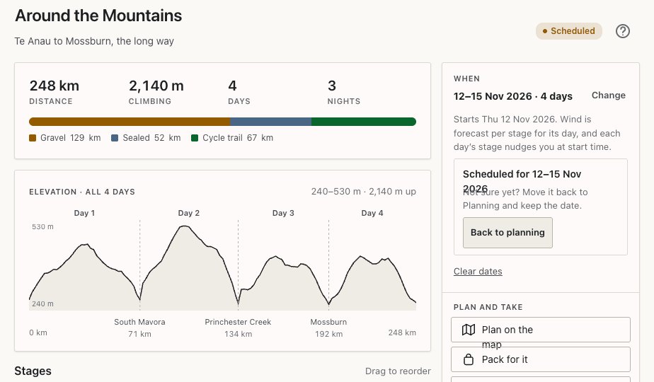
A trip is a run of days. Each day is a stage with its own route, distance, climbing, elevation profile and surface mix. A day ride is just a one-stage trip. Edit anything, even mid-trip. Plan on an iPad, Mac or computer; only the phone on the bars rides.
Every day, laid out
Each stage shows distance, climbing, the profile and what you'll be riding on.
- Pin details: hold a waypoint to see the leg into it, with distance, climbing, surface and the weather there now.
- Bags on or off by the day. Leave bags at camp and that day’s weight and time follow.
- Delete a day from a trip.
Route-finding built for loaded gravel bikes
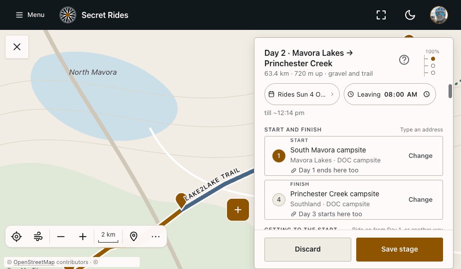
It prefers cycle trails, gravel and quiet back roads, and strongly avoids state highways.
- Sliders for avoiding traffic and avoiding rough surfaces, and Follow cycle routes to keep you on trails like the Lake2Lake.
- Type a start and finish by name, drop a pin, or Where I am now.
- Drag the line to bend the route.
- Detours: tap a road to send the route around it, or compare three ways past.
- Mark any road avoid and it’s remembered for every route after.
Fly the whole ride in 3D
See a ride's map in 3D, then fly it end to end: the climbs, the valleys and the line you'll ride, with distance and height as you go.
The map
Ride layers
Lay NZ Great Rides, the Tour Aotearoa and NZ cycle routes over the map, each with its distance, climbing and days. Australia’s cycle routes from OpenStreetMap are there too.
Places to stop
Water, public toilets, food, cafes, bike shops.
Places to sleep
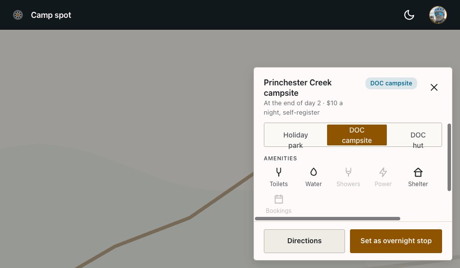
DOC huts, DOC campsites, holiday parks, and riders’ own spots, marked for each other. Huts more than 5 km from anything you can ride are left out.
Riding a trip with others
Share a trip with a code. Everyone rides the same days; each rider keeps their own bike, bags and times.
- The days and the route
- Bike and bags
- Times and weights
Weather on the route, not just at home
Or 10 km away, in a direction you’re not riding. The forecast follows your planned route.
- Headwind, crosswind or tailwind coloured along each stretch of the stage, with gusts.
- Wind arrows along the day, timed to your own start time.
- Rain combined with strong wind flagged as rough going. Rain radar.
- Overnight lows at each camp spot, adjusted for height, with a frost warning.
- Camps compared side by side: ride on to the warmer valley, or stop here.
Works with no signal
Saving a route stores the map, the route, places, camp spots and the forecast on the phone. Most of where you'll ride has no coverage, and the app is built for that.
Caught short finds the nearest water, toilet or place to sleep with no signal at all.
A native iPhone and Android app. It taps into the phone’s own sensors without draining your battery.
GPX for every stage and for the whole trip. Export to device: one file per stage or one for the whole trip.
Map · route · places to stop · camp spots · forecast. Your track while riding is saved too, and sent when signal returns.
Secret Rides is in beta on iPhone and Android. Put your name on the list and Doug picks testers from it.